Race Report: Beaver Lake Sprint Tri 2011

Date: Aug. 20, 2011

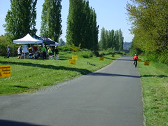
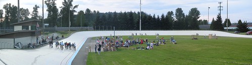
Location:Beaver Lake Park, Sammamish, WA

Photo Gallery: Flickr.com set

The Beaver Lake Tri is one of my favorite races: it is small and intimate (under 300 participants this year), the location is gorgeous, and it is in my back yard. OK, not literally in my back yard but I only have to drive a couple miles. Last year was almost a colossal failure. I was intent on NOT repeating the same mistakes from last year. This would also be the first race in which I actually used the multi-sport functionality of my Forerunner 310XT. I wanted to use it last year but neglected to actually bring it to the race. It sat comfortably on my desk charging its battery that year. This time I not only remembered to bring it, but I was able to get the splits to match the official splits to within 2 seconds! That may not seem like much to most of you but for a first-time use I was pretty amazed.

Pre-race

The night before I slept really well, which is unusual for me. I am the kind of person who gets major butterflies in the stomach before highly anticipated events, including triathlons. This time was no different. As I laid awake in bed I went over my pre-race checklist, walked through my morning routine, and visualized the entire race from beginning to end.

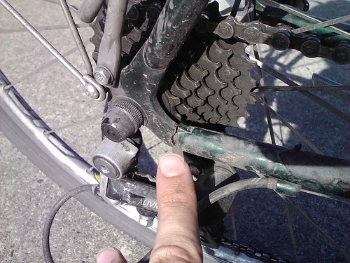
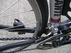
I had a wheel issue last month that required me to replace both the wheels on my road bike (more on this in a later post). As I approached race day (and even as I write this post 10 days later) my new road wheels had not arrived. A friend at work graciously offered to loan me his Mavic Ksryium rear wheel for the race (I have a spare front wheel). If you look closely in the pic below you can see that it is not my usual wheel. This required quite a bit of tuning to fit properly and to get the derailleur to reach all the gears. In the end it worked flawlessly and allowed me to focus on other race-day issues.

I woke up 5 minutes before my alarm went off at 5:30 am, another unusual happening. It typically takes the sound of a dump truck or blasting rock and roll to get me out of bed in the morning but not today. Even the kids were up early and ready to roll right on time.

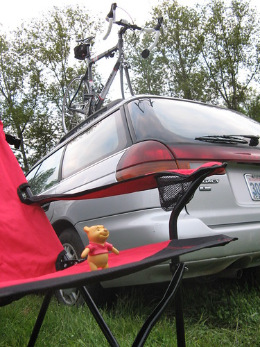
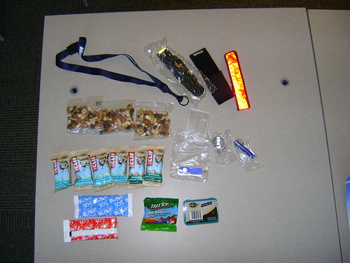
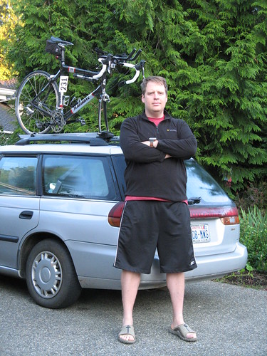
Packed up and ready to race!

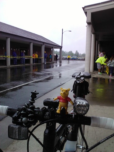
The transition area was already packed when I got there at 6:30 am. With such a small race it doesn't take long to find your transition area which is nice during the race. It's easy for a slow person like me to have sub-90 second transition times.

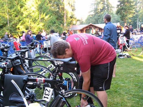
Setting up my transition areaThe weather was sunny and somewhat warm but the water was even warmer (somewhere around 75F). Once again the entire family came along to volunteer at the race. If you were at the race and saw a tall woman in the food area, that's my wife.


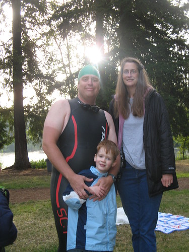
Boy #1 was my official race photog and found the continuous shutter mode. Now if I can only get him to hold the camera still and let it focus between shots...

 Boy #1, my race photog for the dayThe Swim

After the obligatory "mandatory race meeting" I had the opportunity to be a spectator for nearly 45 minutes as wave after wave of people started in front of my group. Around 8:15 am they finally called us into the starting pen and away we went. My traditional strategy of "wait for everyone else to go first" kind of went out the window. I'm not exactly sure why but as the horn sounded I positioned myself in the middle of the pack where I stayed for the entire race. I'm not sure how I did it but I actually passed a couple of people! Not a single person passed me after the initial "wash tub" start, not even the next wave, which started 3 minutes after us. This is unusual for me since my "freight barge" racing style makes me a prime confidence booster for the faster swimmers. This year I felt unusually fast and even turned up the speed in the last 50 meters. I came out of the water feeling great with lots of energy.

Swim result: 8:29, OA: 204/283, AG: 11/20 (Clydesdale)

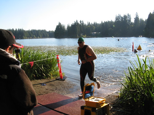
Exiting the swim with a new PR!

T1 T1 Result: 3:41, AG: 15/20 (Clydesdale)

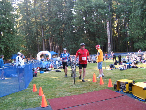
Exiting transition to head out on the bike

The Bike

Notice the guy in front me as I exited T1? Number 295 and I played tag on most of the bike. We are very similar in size although I think he may be a few pounds heavier than me. He is also 13 years older. About two-thirds of the way up the big climb on Issaquah-Fall City Road he passed me for the final time and didn't see him again until the finish line food area. He beat me by just over a minute overall.

I downed a Gu Roctane gel within the first 2 miles. It's amazing how fast you can open/eat one of those gel packs without taking your arms off the aerobars. The bike felt REALLY good through the flat section and down the big descent on Duthie Hill Road. I even felt good climbing although I couldn't quite keep up the climbing pace I had hoped for. As I crested the longest climbing section I cautiously approached my nemesis, a 90-degree left hand turn near 287th Ave SE where I crashed the previous year. This time I did it perfectly: I came into it in the right position and at the perfect speed to hold a fast turn through the apex and out the other side. At least that's how it went in my dream the night before. The reality is that I slowed down a little more than I should and a faster cyclist behind me caught up and tried to pass on the inside of that heinous curve. I could hear him approaching from behind by the sound of his freewheel and yelled at him to watch his speed in the turn. He slowed down and waited to pass until after the turn, for which I shouted my approval with a HUGE "Thank you!" and the hardest part of the race was over.

...or so I thought. After a mile of downhill and that nasty curve we were met with another half mile of moderate climbing. This is where the cramping began. My left calf muscle locked up tight with very little warning. With only 2 miles to go my left leg was essentially useless: I could continue to flex my left knee only if I pedaled with my right leg, which I did all the way back into transition. This slowed me down quite a bit. My goal time was 40 minutes and I missed it by a whopping 10 minutes. Throughout the bike I was steadily draining my Nuun-water which I was hoping would help me avoid problems like this. The slowdown was evident in my pacing as my average went down to 15 MPH from 19-21 MPH on the other flat/rolling sections.

Bike Result: 50:13, OA: 184/297, AG: 15/20 (Clydesdale)

T2

I went through T2 in record time making up almost an entire minute on my fastest T2 time in this race. As I left T2 I downed another Gu gel and off I went.

T2 Result: 1:26, AG: 9/20 (Clydesdale)

The Run

The run was almost uneventful. Since our wave was so far back in the time schedule there weren't many folks left out on the course. They put all the under-18 racers in the last wave and many of them passed me (as they should!). At times there wasn't a soul around me either in front or behind. At one point I thought I had taken a wrong turn until I crested a hill and found a water station. I was feeling good until I passed the "Mile 2" marker where my cramping problems began again in earnest. This time my right hamstring muscle was locking up in a major way very similar to my previous left-calf cramp. It loosened up a bit during mile 4 and I was able to increase my pace. This is evident in my split pacing-

Split Time Avg Pace Distance Elevation Gain Avg HR
1 0:09:51 9:51 1 65 156
2 0:09:53 9:52 1 21 154
3 0:10:20 10:19 1 58 153
4 0:09:26 9:26 1 31 156
5 0:02:02 8:32 0.24 0 159
Total: 0:41:32 9:47 4.24 176 155


In the final 200 yards the cramping became pretty intense and I was unable to bend my right knee. Somehow I kept going and hobbled toward the end. The cramping had really slowed me down and I was 6 minutes behind my goal time.

As I reached the finish line I heard a familiar voice announce my name and city: Boy #1 had somehow talked his was into the announcers area. It was really cool to hear my son say, "Yay, Dad!" over the loudspeaker. I'm not sure how he pulled that one off.

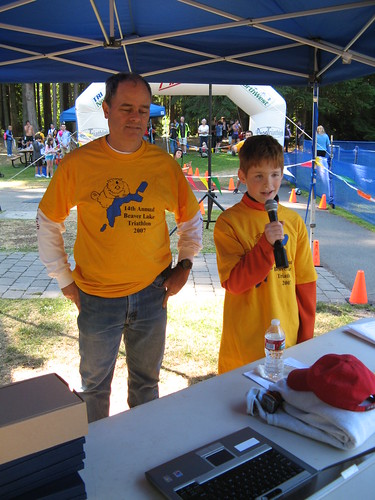
Boy #1 announcing my race finish.

I was greeted with a big hug from Boy #1 as I limped straight-legged toward the food area. The conversation with the chip-removal girl went something like this-

CRG: "Please put your foot up here." (on a milk crate so she could cut off the chip strap)

Me: "Uh, I don't think so. I can't bend my knee."

CRG: "Oh, that's OK, at least you can walk. Hold still and I'll get it for you."

She was very polite and accommodating, just like the rest of the volunteers. Did I mention how great the volunteers are at this race?

Run Result: 41:33, OA: 222/279, AG: 12/20 (Clydesdale)

Total time: 1:45:23, OA: 194/262, AG: 14/20 (Clydesdale)

Post Race

Well it wasn't anywhere near my goal time of 1:28:00 but I did set a new PR of this event and recorded my fastest 400m swim split EVER. Several folks in the food area were commenting on how short they felt the swim course may have been (maybe around 350m?). Since I was swimming pretty close to my training pace I can't say that it was shorter or longer but I am happy with the result.

My bike and run times were not what I was hoping for but overall I can't complain too much. My time reflects my training effort and lack of consistency in training schedule. At least it gives me something to shoot for next year!

My experience using my Garmin 310XT during the race was a very positive one. For the first time I was able to track bike and run paces and know exactly where I stood in my goal times. I'm sure that in longer races a power meter of some sort on the bike would have been very helpful to make sure I was in my power zones. As expected the GPS tracking on the swim is downright useless, even with open water mode enabled. It looks more like an attempt at modern art than a race course.

Recovery

I found the perfect way NOT to recover from a race: sit in a car for 7 hours! Within an hour of finishing the race we were packed up and on the road to California to spend some of our summer vacation with my folks. That night we arrived at our overnight hotel by 9pm and I was in bed and sleeping within 15 minutes. I can't say that I recommend this as a preferred race recovery method.

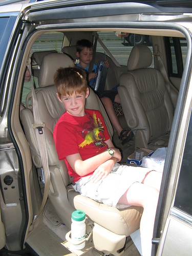
Boys #1, #2, and #3 crammed into the van for a long trip to Grandma's house.

Iron Horse Trail Ride Report (Almost)

On July 5, 2011, the Snoqualmie Tunnel was re-opened after completion of a significant repair project. This tunnel is part of the John Wayne Pioneer Trail in Iron Horse State Park just east of Seattle, WA. It was closed in 2009 (actually didn't reopen after the '08-'09 winter closure) due to safety concerns (falling rocks and an underground RIVER flowing through it). The tunnel was fenced off with big warning signs advising you not to enter...

Snoqualmie Tunnel east entrance, Snoqualmie Pass, WA, as it looked in 2009-2011 during the safety closure. 

This tunnel has been on my "bucket ride" list ever since I heard of it when I first moved back to WA in 2001. I never made it up there until they closed it. Then the economic downturn and state budget cuts made it seem like they would never get it fixed. I heard about the opening several days after it happened (I was out of town on vacation at the time) and was pleasantly surprised.

Trail surface: gravel, packed gravel, and packed dirt.

Bike recommendations: anything with tires wider than 28mm (i.e. don't ride on a road bike with skinny tires). Cyclocross bikes should be fine. The last time I rode I was on a bike with 26" x 1.7" road tires and they worked great.

The WA State Park Service has contracted with a private company to provide a shuttle from the trailhead, near Cedar Falls and Rattlesnake Lake, all the way up to the summit at Hyak. This allows you to park your car and, for somewhere around $20, you and your bike can be shuttled up to the top and ride the ~23 miles downhill back to your vehicle. Total time, including shuttle ride, should be in the neighborhood of 3 hours.

I fully intended to ride through the tunnel with 2 of my kids (the 2 that can ride) leaving the other home with Mom but when Saturday arrived Mom was sick in bed. Change of plans! Our ride down the trail turned into a hike through the tunnel with some geocaching thrown in for good measure.

We started out playing the compass game...

Playing the compass game at Snoqualmie Pass, WA

To play the compass game you simply find an object in the distance, using your compass to get the magnetic bearing. Then you have someone else stand in the exact same spot (very important!) and try to determine which object you were pointing at using only the compass bearing. My kids love to try to stump Dad but I always get it. }B^)

We ate some lunch and read the information signs at the Hyak parking lot along the trail.

Informational board at the Hyak parking lot, Iron Horse State Park, WA

And then we hiked the very short distance (less than 1/3 of a mile) to the tunnel entrance. This is the east entrance of the Snoqualmie Tunnel.

East entrance of the Snoqualmie Tunnel, Iron Horse State Park, WA

Inside the tunnel we hiked for about half a mile before we turned back. My boys were not in the mood to hike the nearly 2.5 miles to the west entrance on the other side of Mt. Catherine. So we hiked in a bit, found a geocache, and called it a day.

Looking out toward the east entrance, Snoqualmie Tunnel, Iron Horse State Park, WA

So the tunnel is open ready for riders. The trail in the tunnel was very smooth but a bit moist. There are a few dripping leaks from the roof (expected in a 100+ year old tunnel) but the eastern 1/3 of the tunnel is virtually brand new trail surface and walls/ceiling. I'll be back again this summer with my boys to ride the tunnel and trail again.

Our next stop was a great little lake called "Gold Creek Pond", a reclaimed gravel pit right across the freeway from Hyak on I-90. This is a very picturesque lake with picnic tables, a paved trail around the perimeter, and great views of the mountains. We intended to ride our bikes on the perimeter trail but USFS rules stated "no bikes" so we ended up walking.

Gold Creek Pond near Snoqualmie Pass, WA

If you are looking for a quick picnic at Snoqualmie Pass this is a great place. The trail was flat and easy, the picnic tables are 100 yards from the parking lot, and there weren't many people around.

To make up for the fact that we didn't get to ride in the tunnel or around the pond our next and final stop was the Marymoor Velodrome, Marymoor Park in Redmond, WA. This is one of my boys' favorite places to ride, and for good reason-

Marymoor Velodrome, Marymoor Park, Redmond, WA

The track itself is open to the public (when not in use for classes or races). The surface is textured concrete with banked turns and a 400m circumference. This is one of the few outdoor bike tracks in the western US and it is just a few miles from my house! I highly recommend checking it out and taking a few laps. 

As I was playing around on the track with my oldest son I broke the frame on one of my favorite bikes, my nearly 18 year old Schwinn High Plains. After nearly 10,000 miles it finally gave out under my weight. I can generate a lot of torque and have replaced many parts on this bike over the years. It's like losing an old friend. Yes, I almost cried.

Broken rear dropout, drive side on the rear wheel of my 1993 Schwinn High Plains after nearly 10,000 miles. Goodbye old friend! 

...but then I remembered something very important: NOW I CAN GO BIKE SHOPPING! In the past 3 years this bike has served as my year-round commuter bike and has seen everything from thunderstorms, sleet, and hail (which really hurts your face). Now I need another bike that can fill this void.

Upcoming posts: shopping updates!


Tour de Blast 2011

Elk Rock Viewpoint, Mt. St. Helens National Monument during Tour de Blast 2011On Saturday, June 18, 2011, I participated in the Tour de Blast, a fabulous ride up SR504, the Spirit Lake Highway. It starts at Toutle Lake High School, going all the way up to the Johnston Ridge Observatory in the Mount St. Helens Volcanic National Monument.

This ride has been on my "to do list" for quite some time. Last year somebody called it "Tour de Frost" in reference to the very cold/wet weather they experienced. It even snowed at the turn-around at Johnston Ridge. The weather patterns this year are very similar to last year so I decided not to take any chances and significantly over-packed.

I brought everything except my rain bike: shorts, thermal pants, rain pants, rain jacket, winter gloves, short gloves, balaclava, thermal shirt, shoe covers, wool socks, regular socks... the list goes on. Why did I do this? Because the weather at this altitude is incredibly unpredictable. As I drove to the camping area the day before the sky was clear with temps in the mid-70's, a perfect late spring day in Western Washington. A couple of days before I pulled a graphic from weather.com showing the extended forecast. Can you guess on which day the ride was scheduled?

As I arrived at the camping area (a field next to Toutle Lake High School) the weather was gorgeous. I pitched my tent and enjoyed good conversation with my neighbors as well as a good novel. As far as camping goes it was fabulous. Little did I know this was the highlight of the trip.

Camping at the Toutle Lake High School

As I went to bed I noticed some high clouds rolling in. By 1am I was awakened by HEAVY rain which lasted through the rest of the night and all the next day. I finally got up about 6am, packed up my things, and got ready to ride. This is where some decisions had to be made - how do I dress for the ride: winter commute gear? light rain gear? no rain gear at all and hope the rains stop altogether? The weather forecast called for temps in the upper 50's and a 40% chance of rain. With this in mind I opted for the light rain jacket, short gloves, and rain pants over my short sleeve jersey and bib shorts (mistake #1).

Just as I was about to start out on the ride I found Gordon, a friend from work who just arrived at packet pickup. He asked, "Have you already been out and come back? You are soaked!" No, I just walked across the field from the camping area to the start/finish line. Yes, it was that wet but the temp was in the upper 50's and felt quite warm (mistake #2). And on that note I started up the mountain.

Start/Finish area, Toutle Lake High School

The first 13 miles were slow with some rollers. Within the first 10 miles I found the "unofficial Tour de Blast Rest Stop." They call it "unofficial" because they give away free beer. I'm sure the ride organizers cannot endorse this because it may lead to someone "riding under the influcence". In Washington State you can be charged with DUI for riding a bike while drunk. I passed them around 7:45 am and they were already out hootin' and hollerin' as riders went by, with a big sign advertising "free beer". They were already drinking as I went by and I'm sure the party went on well into the night. They even had a guy dressed as sasquatch. Very cool in attitude in such a small town.

Around mile 5 I noticed that my Garmin was registering my speed as 33 MPH. While I would love to think that I'm in pretty good cycling shape, I'm not THAT fast. I did a quick adjustment (changed wheel size in the bike profile to "auto") and within a minute it showed my actual speed of 16-18 MPH in the flats. Within a few more minutes my Garmin kept beeping at me with "auto pause" and "auto resume" notifications, effectively telling me that I was starting and stopping even though I was riding down the road at a fairly constant rate of speed and cadence. This is an ongoing issue I am having with my Edge 705 and the cadence sensor (more on this in a later post when/if it gets fixed). To fix it I simply disabled the cadence sensor which leaves the system to use your GPS coordinates to calculate speed and distance traveled rather than the cadence/speed sensor on the back wheel. The end result of these 2 issues is that my ride profile shows me going very fast in the first few miles and about 2.5 miles further than it actually was.

As I hit the first rest stop I was feeling good. The legs were great and I had a lot of energy. The only downside was that I was completely soaked through. This actually happened in the first few miles but the slow and steady climb raised my body temp enough that it was easy to stay warm. The food was fabulous: fruit bars, brownies, fruit, peanut butter bagels, and lots of sports drink. After a few minutes of food and liquids I was back on the road.

The first rest area, Hoffstadt Bluffs Visitors Center, Mt. St. Helens National Monument, Tour de Blast 2011

The climbing really began in earnest after the first rest stop. The grade changed sharply from 1-4% to 6-9% (as registered on my Garmin). I kept up a slow but steady pace of 6-7 MPH and slogged up the cold and wet road. The views along the way were very limited, even at the very picturesque Hoffstadt Creek Bridge.

 The Hoffstadt Creek Bridge, Mt. St. Helens National Monument, along SR504.

At this point I was doing pretty well, finding my "groove" but starting to feel some fatigue in my legs. My lack of training (mistake #3) became very apparent as I approached the second rest stop.  

A rider climbs up the last few yards to the second rest stop at the Elk Rock Viewpoint, Mt. St. Helens Volcanic National Monument

The second rest stop was quite crowded. They had a tent and a couple of canopies setup. The tent had copious amounts of food while the canopies were crowded with riders huddled around 2 fire stands setup to keep people warm and dry.

The second rest area on Tour de Blast 2011, Elk Rock Viewpoint, Mt. St. Helens National Monument.

As I filled up on snacks and water I spoke at length with a support guy standing next to a while board with the temp and conditions posted along with mileage and climbing elevations on the next two climbs. It didn't look good.

Current conditions at Elk Rock Rest Stop: 46F, Raining

Current conditions at Johnston Ridge Rest Stop: 40F, Sleeting

I walked over to the fire to warm up and dry out a bit while chatting up the other riders to see if any of them had made it to the top. No one there had been to the top yet and most intended to either turn around right there or wait for the SAG wagon. As I stepped away from the fire, fully intending to ride up to the top, the wind kicked up with some really strong gusts and the rain started blowing sideways. It continued for 15 minutes. As I waited I did dry out a lot but started getting colder and colder (mistake #4). The combination of the wind and low energy output (riding up the hill was keeping me quite warm) started to really bring down my body temp.

My next thought was, "I'm done, time to ride down." I hopped on my bike and started down the mountain. I made it only about 1/4 mile before I was forced to stop. My hands were shaking so badly that my front wheel was unstable. At downhill speeds in the 30-40 MPH range this could be very dangerous. It also signaled the first stage of hypothermia, uncontrollable shaking and somewhat blurred vision (eye issues will be yet another topic for a future post). I slowly climbed back up to the warmth of the rest stop to wait for the SAG Wagon.

Pooh Bear enjoying the ride back to Toutle Lake High School aboard the SAG wagon.

The SAG Wagon was a small bus similar to the smaller busses used by some transit agencies on short routes or in small towns. There was no bike rack so we put our bikes in the aisle, as many as would fit, and hunkered down for the 30 minute ride back to the start. My day was finished. This was the first, only, and hopefully last time for the SAG wagon.

Speghetti and meatballs! A great (warm) way to end a long/cold ride.

OK, it was almost finished. Back at the High School we were served a very warm and yummy spaghetti dinner by the Rotary Club volunteers. I'm not sure which was better: the warm food or the actually very tasty pasta. I followed it up with a big vanilla ice cream with strawberry sauce.

And there you have it. Score - Me: 0, Mt. St. Helens: 1

I made lots of mistakes on this one-

  1. Did not dress appropriately for conditions. I had the right clothing in my bag in the car: thermal shirt, balaclava, thicker Showers Pass rain jacket, and Gore rain gloves. If I had over dressed, just like I had over-packed, I would have been much warmer and continued the ride. Without a doubt.
  2. I trusted the air temp at the bottom and did not ask the ride officials about weather conditions up the mountain.
  3. Lack of training. Gordon asked me earlier in the week how my training was going. My quote: "I've been tapering for a month!" That's my sarcastic way of saying I wasn't prepared. And it showed.
  4. I waited too long at the rest stop before continuing on. Because of this my core temp went way down and it went downhill from there.

I ate my lunch with some of the race organizers. They passed on some interesting stats:

Registered riders: about 950 (permit allows for 2500 riders)
Riders who picked up their packets: around 750
Number of riders who actually went out on the ride: 600

So how did Gordon do? He made it to the top! With 1.5 miles left he had a flat and rode that last bit on a flat front tire. I'm sure his speeds were slow enough that this wasn't an issue. He also didn't want to stop and give up his momentum, physical and mental. Then he made it all the way back to the High School.

Another friend from work, Bret, put this in his ride report: 

"Before we start, our group typically gets together and shares some kind of inspirational/motivational thoughts. I thought I would be funny and use a quote from the biblical story of Noah’s ark, apropos the weather: And the waters prevailed exceedingly upon the earth; and all the high hills, that were under the whole heaven, were covered. (Genesis 7:19) People in general are not amused. Literally as we wrap up our little pre-ride meeting, it starts to rain harder."

Brett made it to Elk Ridge and then turned around and rode all the way down. He, at least, was prepared for that, unlike me.

Summary

Ride Stats-

  • Rolling Time: 2:53:03
  • Actual Time: around 4 hours (included rest stops, warming by the fire, and SAG ride)
  • Rolling distance: 29.19 miles (distance is suspect, about 2 miles more than it should be)
  • Average rolling speed: 10.4 MPH
  • Elevation Gain: 3630 feet
  • Average Heart Rate: 142

Highlights:

  • Perfect camping conditions the day before.
  • Camping on-site allowed for quick prep for the ride.
  • FOOD! Wonderful food at the rest stops and a pasta feed at the end, with ice cream!

Lowlights

  • The weather day of the ride.
  • Not mentally prepared for the cold
  • Not dressed for the cold and wind
  • Didn't train enough hills, although I didn't stop due to training limitations
  • Issues with my GPS continue to frustrate me.

Will I be back again? - Absolutely. I want to conquer this one.

Would I recommend it to a friend? - Yes!

Post Ride

During the drive home (2.5 hours) it rained the ENTIRE way. This was a much bigger rain system than the computer models were letting on (refer to the 30% chance of rain above).

Ride recovery was fast since I didn't actually ride that far. As an example, my commute to/from work the next day was quite fast. I use the "Courses" feature on my Garmin to track my commutes to/from work. I use the best ride from the previous month and try to beat it each time I ride. This time I had a PR (personal record) by almost a full minute, breaking 34 minutes for the first time on this particular route. That means I had something left in the tank and very well could have finished the ride from a training perspective. Oh well, there's always Tour de Blast 2012!

Looking forward to Cycle Oregon 2011!

}B^)


Ride Report - Bike To Work Day 2011

Commuter Station at NE 124th between Redmond/WoodinvilleLast Friday, May 20th, was Bike To Work Day (BTWD), a great excuse to get people to ride their bikes to work who usually don't have the time, energy, or motivation to otherwise do so. What does that mean for those of us who regularly commute via bike? More people to share the fun! The more people we can get biking the better.

There are bike snobs out there (sorry, I refuse to link to them) who think that Bike To Work Day is the worst day of the year. Some of those even boycott the day completely. I relish it! OK, maybe not, but I am no where near the attitude I refer to. If you want to read the vile put out there about the N00bs who dare to get in their precious way, then please go and do a search yourself. Go ahead, my blog will be waiting for you when you get back from cleaning the vomit off your keyboard.

My favorite BTWD in 2008 was the best. I was in fabulous shape (compared to years previous). I pulled up to a stoplight at the back of a pack of about 20 cyclists waiting to go up a big hill (corner of E. Lake Sammamish Pkwy and Leary Way in Redmond). As the light turned green the guys in the front (obviously not regular riders) were having trouble getting started which caused the group to stop, accordion style. I pulled out to the left of the group and was able to pass the entire group. As I climbed the hill I was able to look back using my rear-view mirror to see the incredible carnage playing out behind me: people falling over because they stopped mid-stroke and couldn't unclip, pushing their bikes (out of shape), while the regular commuters weaved around them trying not to become a victim themselves. Overall there were no serious injuries but lots of colorful metaphors.

This year I decided to do something new: a long route starting early in the morning that would take me by 2 of the BTWD commute stations (i.e. SWAG stops). I even invited some friends from work to join in the fun.

  • Start time: 7:20 am
  • Estimated distance: 19.24 miles
  • Estimated climbing: 1033 feet
  • Estimated time: 90 minutes
  • SWAG stops to hit: 2

Of course things don't always go as planned...

  • Actual start time: 7:35 am (missed meeting my friends)
  • Actual distance: 28.87 miles
  • Actual climbing: 1520 feet
  • Elapsed time: 2:01:55
  • Swag stops hit: 3

      Commute Station on the Sammamish River TrailThe weather was FABULOUS (sunny, highs in the 60s) with very little wind. I kept to my route for the most part but diverted north on the Sammamish River Trail a bit to hit a third SWAG stop in Woodinville. The bad news was that they were closing up shop. The good news was that they told me to take as much food as I wanted because they didn't want to transport it. SWEET! I loaded up on samples of nuts, dried fruit bars, Cliff Bars, and assorted other snacks (this proved useful later). The other commute stations along the way at 60 Acres and the 520 trail were also very thin so I didn't stay long at either place.

The final destination of the morning was a BTWD breakfast hosted by my employer but when I arrived I found that they had literally just run out of food. No! What was to be the highlight of my day turned out to be a bit of a downer. As I was sulking, looking at the empty tables, a good friend, Steve, arrived as well to find the bad news. That's when I remembered by bag full of snacks! The two of us sat down, exchanged ride stories, and chowed down on all the snacks I picked up earlier. The morning had been saved.

Overall the day was a success: I got in my long-ride for the week, hit the commute stations, ate some pretty good food, and socialized with some friends. When I got back to the office I took inventory of the SWAG take for the day, including the snacks that weren't eaten earlier...

BTWD SWAG collection

My ride home was supposed to be an easy 8-mile ride that I have done hundreds of times before but it was not to be. Only 3.5 miles into the ride I popped a spoke nipple and ended up taking the bus home...

Popped rear spoke, drive side spoke nippleMy saving grace, KC Metro route 269

To end the day I took the family down to the Marymoor Park Velodrome in Redmond for some bike racing action. My kids eat this stuff up, especially the Kiernan race with the scooter...

Setting up for the Cat-4 Chariot heat

Next year I think I'll start something new: "Bike to anywhere but work day," thinking that I will take the day off to just bike anywhere that suits my fancy.


Ride Report: Presidents Day Ride 2011

Every Presidents Day holiday for the past few years I have organized an informal ride with friends. Those of you from the Seattle area should be shaking your heads by now. Why? Well, the average temp range for Presidents day in Seattle are a bit on the chilly side (Hi: 52F, Lo: 36F). Since I typically leave before 8am the temps can be somewhat chilly. In '08 the temp was 27F when I departed at 7:15 am. With this in mind attendance ranges anywhere from 2-15. Suprizingly my luck with weather on this ride has been fabulous: nothing more than fog, typically with lots of sun. This year was not different with overcast skies, slight snow flurries, and some breaks in the clouds.

Each year the ride typically ends up on the I-90 trail from Sammamish to Pac-Med in Seattle. This year we decided to do something different at the request of my son (Boy #1): the John Wayne Pioneer Trail at Iron Horse State Park. With some intrepidation and snow in the forecast we loaded up the car at 7am and headed for the trailhead. Unfortunately I forgot our camera so we had to make do with my cell phone camera (i.e. not the best quality pics/videos). Iron Horse State Park

For those not familiar, Iron Horse State Park is a "rails to trails" park that has one of the best kept secrets in WA state. One of our friends on this ride, a long time WA resident, had heard of the trail but never actually seen it. The trail is a retired rail bed converted into a hiking/bicycle trail (At the time of this writing, 2/23/2011, you could also use it as a cross country ski trail with all the snow received this week). I took a group of Boy Scouts on a 3-day ride on the same trail back in '09. The ride is easy (never more than a 2% grade), well maintained, and quite scenic with views of waterfalls, the Cascade Mountains, high bridges over the canyons, and lots of wildife.

We met up with a couple of friends (bringing the group size to 4) and headed out on our adventure. Some highlights:

  • The trail was smooth and frozen: warmer weather would have meant more mud to contend with.
  • Although there were a few small sink holes the trail was in great shape.
  • Lots and lots of ice on the cliffs and around the running streams but no ice over the trail. On one of the cliffs, where the ice covering the cliff face was beginning to melt, air bubbles were flowing with the runoff under the ice making it look like there were ants crawling underneath (I tried to take a video but it didn't turn out well).
  • We had remarkable visibility, despite the overcast skies, which gave us great views of the valleys and mountains.Views of the Mountains from the Mine Creek bridge
  • Best part of the ride (according to Boy #1): the fast ride down.
  • Good conversations with our friends over the course of the day.
  • We came across a mountain goat on the Deception Craggs climbing cliff. Very unexpected and cool.

Lowlights:

  • Did I say it was chilly? BRRRR! (30F when we set out)
  • Someone had taken some pot shots at the signs with a shotgun. We saw other rifle/shotgun damage to signs, posts, and rocks as well as some clay pigeon remnants. They even shot the "no shooting" sign.
  • We only had 4 hours to do the ride, which meant we covered 8.5 miles before we had to turn around.

Lessons Learned:

  • Next time Boy #1 needs a bigger bike: 26" tires would have made a big speed improvement for him.
  • Drink more water. Although I brought 2x20 oz bottles, I didn't drink more than 10 oz.
  • Breaks needed to be longer in duration for our two younger riders. At 90 minutes Boy #1 struggled a bit.

After just over 2 hours we decided to return. As you can see in GPS ride profile the return trip was a bit faster than the first half. On the way home we stopped in Fall City at "Small Fries", one of our favorite hole-in-the-wall burger joints. That's how we top-off after a great ride in the mountains!