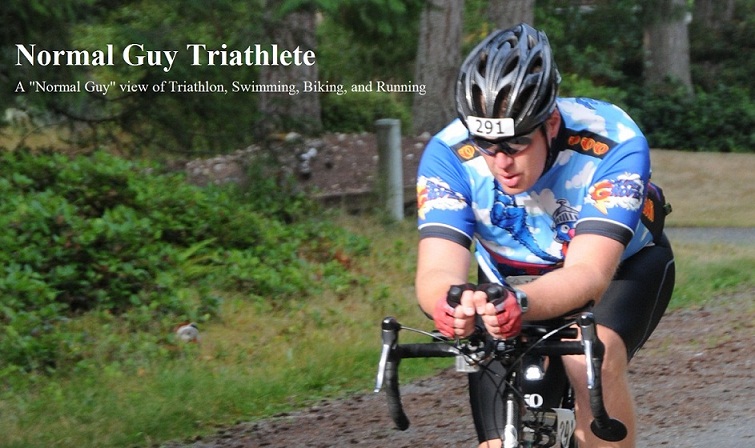
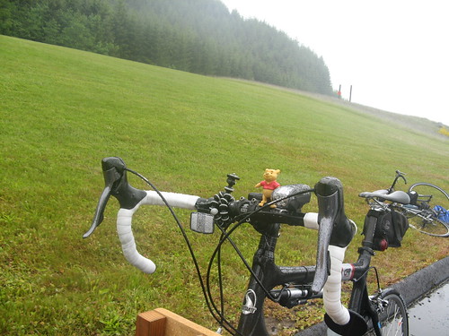
 Elk Rock Viewpoint, Mt. St. Helens National Monument during Tour de Blast 2011On Saturday, June 18, 2011, I participated in the Tour de Blast, a fabulous ride up SR504, the Spirit Lake Highway. It starts at Toutle Lake High School, going all the way up to the Johnston Ridge Observatory in the Mount St. Helens Volcanic National Monument.
This ride has been on my "to do list" for quite some time. Last year somebody called it "Tour de Frost" in reference to the very cold/wet weather they experienced. It even snowed at the turn-around at Johnston Ridge. The weather patterns this year are very similar to last year so I decided not to take any chances and significantly over-packed.
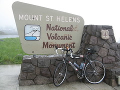
I brought everything except my rain bike: shorts, thermal pants, rain pants, rain jacket, winter gloves, short gloves, balaclava, thermal shirt, shoe covers, wool socks, regular socks... the list goes on. Why did I do this? Because the weather at this altitude is incredibly unpredictable. As I drove to the camping area the day before the sky was clear with temps in the mid-70's, a perfect late spring day in Western Washington. A couple of days before I pulled a graphic from weather.com showing the extended forecast. Can you guess on which day the ride was scheduled?
As I arrived at the camping area (a field next to Toutle Lake High School) the weather was gorgeous. I pitched my tent and enjoyed good conversation with my neighbors as well as a good novel. As far as camping goes it was fabulous. Little did I know this was the highlight of the trip.
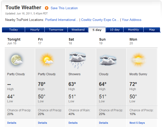
 Camping at the Toutle Lake High School
As I went to bed I noticed some high clouds rolling in. By 1am I was awakened by HEAVY rain which lasted through the rest of the night and all the next day. I finally got up about 6am, packed up my things, and got ready to ride. This is where some decisions had to be made - how do I dress for the ride: winter commute gear? light rain gear? no rain gear at all and hope the rains stop altogether? The weather forecast called for temps in the upper 50's and a 40% chance of rain. With this in mind I opted for the light rain jacket, short gloves, and rain pants over my short sleeve jersey and bib shorts (mistake #1).
Just as I was about to start out on the ride I found Gordon, a friend from work who just arrived at packet pickup. He asked, "Have you already been out and come back? You are soaked!" No, I just walked across the field from the camping area to the start/finish line. Yes, it was that wet but the temp was in the upper 50's and felt quite warm (mistake #2). And on that note I started up the mountain.
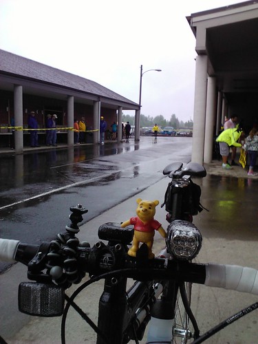 Start/Finish area, Toutle Lake High School
The first 13 miles were slow with some rollers. Within the first 10 miles I found the "unofficial Tour de Blast Rest Stop." They call it "unofficial" because they give away free beer. I'm sure the ride organizers cannot endorse this because it may lead to someone "riding under the influcence". In Washington State you can be charged with DUI for riding a bike while drunk. I passed them around 7:45 am and they were already out hootin' and hollerin' as riders went by, with a big sign advertising "free beer". They were already drinking as I went by and I'm sure the party went on well into the night. They even had a guy dressed as sasquatch. Very cool in attitude in such a small town.
Around mile 5 I noticed that my Garmin was registering my speed as 33 MPH. While I would love to think that I'm in pretty good cycling shape, I'm not THAT fast. I did a quick adjustment (changed wheel size in the bike profile to "auto") and within a minute it showed my actual speed of 16-18 MPH in the flats. Within a few more minutes my Garmin kept beeping at me with "auto pause" and "auto resume" notifications, effectively telling me that I was starting and stopping even though I was riding down the road at a fairly constant rate of speed and cadence. This is an ongoing issue I am having with my Edge 705 and the cadence sensor (more on this in a later post when/if it gets fixed). To fix it I simply disabled the cadence sensor which leaves the system to use your GPS coordinates to calculate speed and distance traveled rather than the cadence/speed sensor on the back wheel. The end result of these 2 issues is that my ride profile shows me going very fast in the first few miles and about 2.5 miles further than it actually was.
As I hit the first rest stop I was feeling good. The legs were great and I had a lot of energy. The only downside was that I was completely soaked through. This actually happened in the first few miles but the slow and steady climb raised my body temp enough that it was easy to stay warm. The food was fabulous: fruit bars, brownies, fruit, peanut butter bagels, and lots of sports drink. After a few minutes of food and liquids I was back on the road.
 The first rest area, Hoffstadt Bluffs Visitors Center, Mt. St. Helens National Monument, Tour de Blast 2011
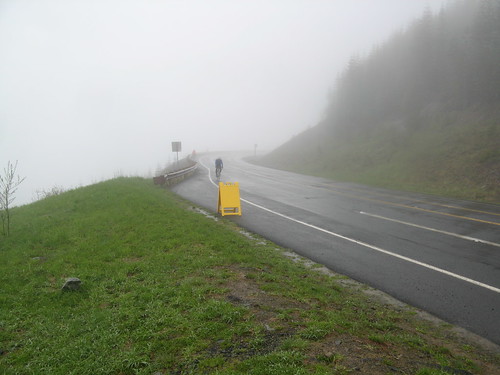
The climbing really began in earnest after the first rest stop. The grade changed sharply from 1-4% to 6-9% (as registered on my Garmin). I kept up a slow but steady pace of 6-7 MPH and slogged up the cold and wet road. The views along the way were very limited, even at the very picturesque Hoffstadt Creek Bridge.
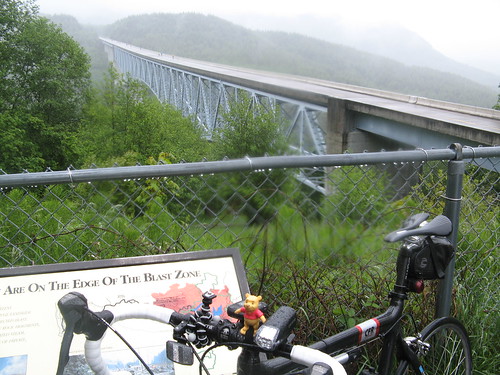 The Hoffstadt Creek Bridge, Mt. St. Helens National Monument, along SR504.
At this point I was doing pretty well, finding my "groove" but starting to feel some fatigue in my legs. My lack of training (mistake #3) became very apparent as I approached the second rest stop.
 A rider climbs up the last few yards to the second rest stop at the Elk Rock Viewpoint, Mt. St. Helens Volcanic National Monument
The second rest stop was quite crowded. They had a tent and a couple of canopies setup. The tent had copious amounts of food while the canopies were crowded with riders huddled around 2 fire stands setup to keep people warm and dry.
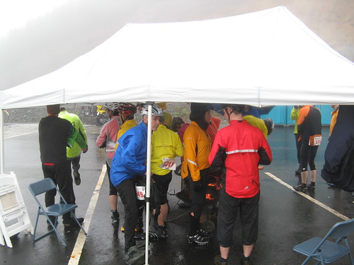 The second rest area on Tour de Blast 2011, Elk Rock Viewpoint, Mt. St. Helens National Monument.
As I filled up on snacks and water I spoke at length with a support guy standing next to a while board with the temp and conditions posted along with mileage and climbing elevations on the next two climbs. It didn't look good.
Current conditions at Elk Rock Rest Stop: 46F, Raining
Current conditions at Johnston Ridge Rest Stop: 40F, Sleeting
I walked over to the fire to warm up and dry out a bit while chatting up the other riders to see if any of them had made it to the top. No one there had been to the top yet and most intended to either turn around right there or wait for the SAG wagon. As I stepped away from the fire, fully intending to ride up to the top, the wind kicked up with some really strong gusts and the rain started blowing sideways. It continued for 15 minutes. As I waited I did dry out a lot but started getting colder and colder (mistake #4). The combination of the wind and low energy output (riding up the hill was keeping me quite warm) started to really bring down my body temp.
My next thought was, "I'm done, time to ride down." I hopped on my bike and started down the mountain. I made it only about 1/4 mile before I was forced to stop. My hands were shaking so badly that my front wheel was unstable. At downhill speeds in the 30-40 MPH range this could be very dangerous. It also signaled the first stage of hypothermia, uncontrollable shaking and somewhat blurred vision (eye issues will be yet another topic for a future post). I slowly climbed back up to the warmth of the rest stop to wait for the SAG Wagon.
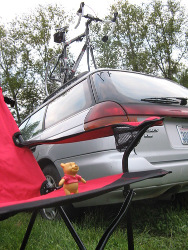
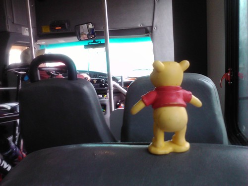 Pooh Bear enjoying the ride back to Toutle Lake High School aboard the SAG wagon.
The SAG Wagon was a small bus similar to the smaller busses used by some transit agencies on short routes or in small towns. There was no bike rack so we put our bikes in the aisle, as many as would fit, and hunkered down for the 30 minute ride back to the start. My day was finished. This was the first, only, and hopefully last time for the SAG wagon.
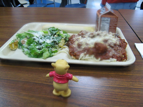 Speghetti and meatballs! A great (warm) way to end a long/cold ride.
OK, it was almost finished. Back at the High School we were served a very warm and yummy spaghetti dinner by the Rotary Club volunteers. I'm not sure which was better: the warm food or the actually very tasty pasta. I followed it up with a big vanilla ice cream with strawberry sauce.
And there you have it. Score - Me: 0, Mt. St. Helens: 1
I made lots of mistakes on this one-
- Did not dress appropriately for conditions. I had the right clothing in my bag in the car: thermal shirt, balaclava, thicker Showers Pass rain jacket, and Gore rain gloves. If I had over dressed, just like I had over-packed, I would have been much warmer and continued the ride. Without a doubt.
- I trusted the air temp at the bottom and did not ask the ride officials about weather conditions up the mountain.
- Lack of training. Gordon asked me earlier in the week how my training was going. My quote: "I've been tapering for a month!" That's my sarcastic way of saying I wasn't prepared. And it showed.
- I waited too long at the rest stop before continuing on. Because of this my core temp went way down and it went downhill from there.
I ate my lunch with some of the race organizers. They passed on some interesting stats:
Registered riders: about 950 (permit allows for 2500 riders)
Riders who picked up their packets: around 750
Number of riders who actually went out on the ride: 600
So how did Gordon do? He made it to the top! With 1.5 miles left he had a flat and rode that last bit on a flat front tire. I'm sure his speeds were slow enough that this wasn't an issue. He also didn't want to stop and give up his momentum, physical and mental. Then he made it all the way back to the High School.
Another friend from work, Bret, put this in his ride report:
"Before we start, our group typically gets together and shares some kind of inspirational/motivational thoughts. I thought I would be funny and use a quote from the biblical story of Noah’s ark, apropos the weather: And the waters prevailed exceedingly upon the earth; and all the high hills, that were under the whole heaven, were covered. (Genesis 7:19) People in general are not amused. Literally as we wrap up our little pre-ride meeting, it starts to rain harder."
Brett made it to Elk Ridge and then turned around and rode all the way down. He, at least, was prepared for that, unlike me.
Summary
- Rolling Time: 2:53:03
- Actual Time: around 4 hours (included rest stops, warming by the fire, and SAG ride)
- Rolling distance: 29.19 miles (distance is suspect, about 2 miles more than it should be)
- Average rolling speed: 10.4 MPH
- Elevation Gain: 3630 feet
- Average Heart Rate: 142
Highlights:
- Perfect camping conditions the day before.
- Camping on-site allowed for quick prep for the ride.
- FOOD! Wonderful food at the rest stops and a pasta feed at the end, with ice cream!
Lowlights
- The weather day of the ride.
- Not mentally prepared for the cold
- Not dressed for the cold and wind
- Didn't train enough hills, although I didn't stop due to training limitations
- Issues with my GPS continue to frustrate me.
Will I be back again? - Absolutely. I want to conquer this one.
Would I recommend it to a friend? - Yes!
Post Ride
During the drive home (2.5 hours) it rained the ENTIRE way. This was a much bigger rain system than the computer models were letting on (refer to the 30% chance of rain above).
Ride recovery was fast since I didn't actually ride that far. As an example, my commute to/from work the next day was quite fast. I use the "Courses" feature on my Garmin to track my commutes to/from work. I use the best ride from the previous month and try to beat it each time I ride. This time I had a PR (personal record) by almost a full minute, breaking 34 minutes for the first time on this particular route. That means I had something left in the tank and very well could have finished the ride from a training perspective. Oh well, there's always Tour de Blast 2012!
Looking forward to Cycle Oregon 2011!
}B^)